Stand by for major hurricane conditions across the Windward Island. The storm guru StormReport@MunichRe.com is predicting that Grenada could soon see hurricane force winds.
The island is often reported by yachtsmen as being one of the safer islands in hurricane season. This is because it lies below the so called 12 degree North line of latitude.
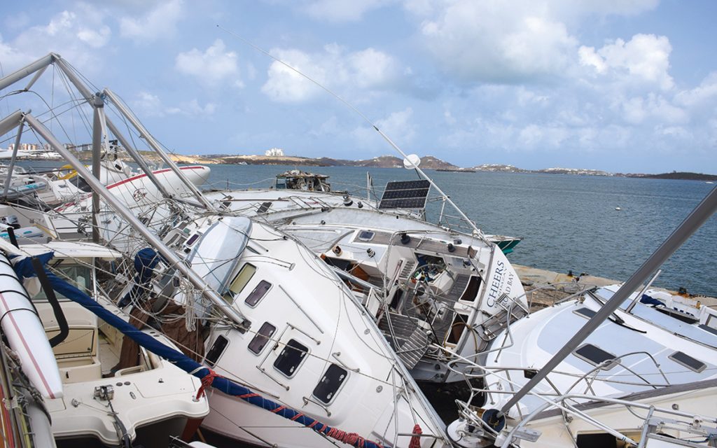
Hurricane Ivan devastated the island of Grenada, flattening houses and severing power supplies in 2004.
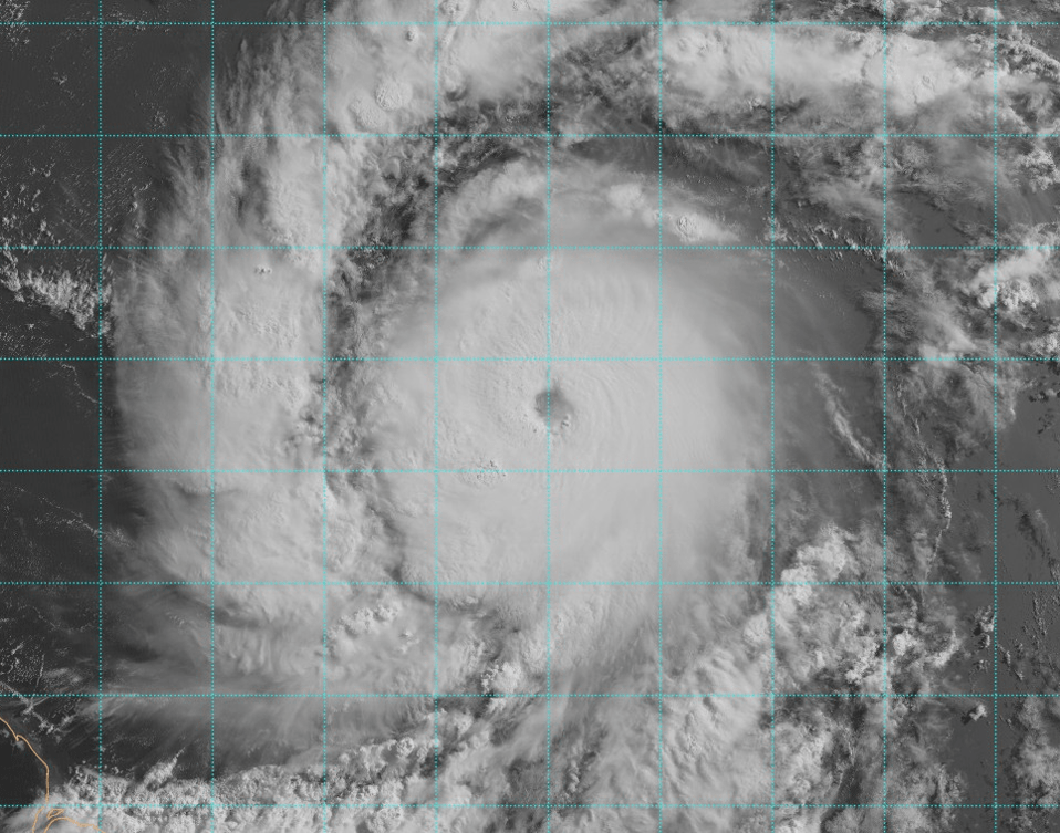
According the storm reporters at MunichRe, Category Four Hurricane BERYL is intensifying rapidly. Currently centred 450 miles east-sou’east of Grenada making 18 knots on a westerly heading. They say, “This is a tiny but vicious storm and likely to pose a significant risk to life and property at landfall.”
If you wish to subscribe to the Storm Report please contact: StormReport@MunichRe.com
A clear, circular eye
Satellite imagery shows a classic major hurricane pattern with a clear, circular eye and a symmetric convection column. Landfall is expected to be near or over Grenada tomorrow morning. At peak intensity with winds gusting up to 140 knots, which as an illustration, is take off speed for a Boeing 737.
The storm currently has a hurricane severity index rating (HSI) of 17 out of a possible 50 points. 4 for size and 13 for intensity. It will peak tomorrow with an HSI of 21 (4 for size and 17 for intensity). The tropical storm force windfield radius is just 85 miles which may open up to 110-120 miles at peak. This tight formation is akin to the impact of an electric drill with very destructive impact within the eyewall.
Outer rain bands will reach the Windward Islands this evening with the worst excesses of wind and rain to the north of the nominal centre. Landfall will not be the end of the story.

Not expected to weaken
BERYL is not expected to weaken significantly as it passes the islands and still likely to be a major hurricane when it enters the Caribbean. There is some upper-level shear ahead in the central Caribbean, which is always good news. But BERYL will still retain hurricane intensity as it shapes up to pass south of Jamaica. And on towards the Yucatan peninsula for a second landfall on Friday.
So stand by for major hurricane conditions across the Windward Island